‘Good fences make good neighbours, but what about bad ones?’
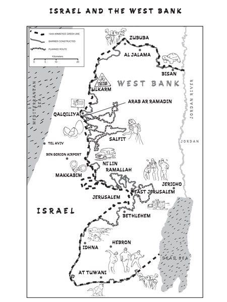
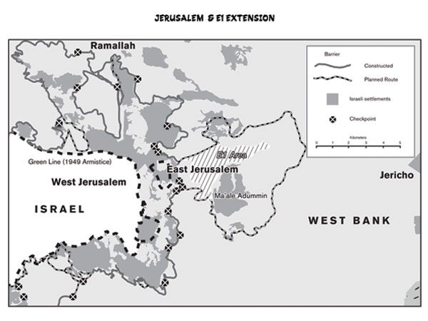
Comedian Mark Thomas and Ebury Press commissioned Mitchells Maps to provide design and illustrations for his new book, entitled Extreme Rambling – a walk along the entire length of the security barrier between Israel and Palestine. The book details Mark Thomas’s excursion, speaking to both sides about life with the barrier. The black and white maps have been designed to be clear, concise and give accurate detailing of the barrier dividing the land, whilst also offering a quirky and iconic view of Thomas’s experiences. The set of four maps accompanying his story illustrate both the existing and proposed route of the barrier to scale and the areas affected on both sides.


